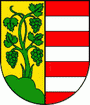
Modra
 |
Modra is famous for its pottery industry. Its blue-and-white porcelain is famous throughout Slovakia. It is also known as one of the most important viticulture centres in the Little Carpathians region.
Besides the main town, there are also other adjacent settlements incorporated in the municipality: former vassalage viticulture village Kráľová and two recreational hamlets of Harmónia and Piesok (also known as Zochova Chata), both located in the woods of Little Carpathians mountains.
Most experts agree that the name is connected to modrá (blue). The name probably originates from another historic geographic name in the neighbourhood, e.g. Modrá hora (Blue Mountain). According to a less probable hypothesis, the name comes from madár (a bird).
Map - Modra
Map


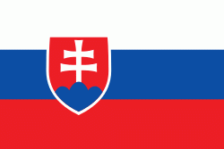
Country - Slovakia
 |
 |
| Flag of Slovakia | |
The Slavs arrived in the territory of present-day Slovakia in the fifth and sixth centuries. In the seventh century, they played a significant role in the creation of Samo's Empire. In the ninth century, they established the Principality of Nitra, which was later conquered by the Principality of Moravia to establish Great Moravia. In the 10th century, after the dissolution of Great Moravia, the territory was integrated into the Principality of Hungary, which then became the Kingdom of Hungary in 1000. In 1241 and 1242, after the Mongol invasion of Europe, much of the territory was destroyed. The area was recovered largely thanks to Béla IV of Hungary, who also settled Germans, leading them to become an important ethnic group in the area, especially in what are today parts of central and eastern Slovakia.
Currency / Language
| ISO | Currency | Symbol | Significant figures |
|---|---|---|---|
| EUR | Euro | € | 2 |
| ISO | Language |
|---|---|
| HU | Hungarian language |
| SK | Slovak language |